
Picterra
Added on:
Social & Email:
Picterra Product Information
What is Picterra?
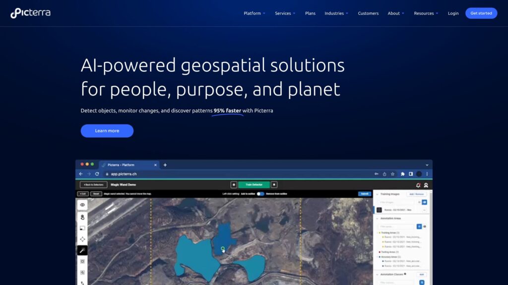
Picterra is a software platform for the training, deployment, and management of machine learning models powering geospatial apps and business services. It provides AI-powered geospatial solutions for detecting objects, monitoring changes, and discovering patterns in satellite, drone, and aerial imagery 95% faster.
How to use Picterra?
Picterra’s cloud-native AI platform allows users to optimize geospatial workflows, detect objects faster, and drive sustainable action. The platform provides tools for imagery sourcing and processing, detector training support, change detection, tracking, and monitoring, as well as dashboard and results customization.
What industries can benefit from Picterra’s geospatial AI solutions?
Picterra’s geospatial AI solutions can benefit industries such as forestry, agriculture, mining, infrastructure, and FMCG (Fast-Moving Consumer Goods).
What are the core features of Picterra’s platform?
The core features of Picterra’s platform include AI-powered geospatial solutions, training, deployment, and management of machine learning models, detection of objects, monitoring of changes, discovery of patterns in satellite, drone, and aerial imagery, and cloud-native platform for optimizing geospatial workflows and driving sustainable action.
What can Picterra help me achieve in terms of efficiency and productivity?
Picterra can help you achieve efficiency and productivity by delivering immediate impact, constantly evolving to enhance performance. What used to take months can now be accomplished in hours. The platform also enables seamless collaboration and effortless sharing of results, and drives scalability beyond boundaries.